28 April 2013 | Kerby, OR -- Seasonal water sources on the Club's Trans-Kalmiopsis Route are already dry, limiting options for early season hikers who want to hike the nine miles from Babyfoot Lake Trailhead to the Chetco River.
Hikers have enjoyed seasonal sources of water at the Bailey Cabin - Emily Cabin junction, as well as at the base of Bailey Mountain on Trail No. 1109. But this year, those sources are already dry, as snowdrifts still loom on the north facing slopes of Babyfoot Lake Rim Trail No. 1126 and Kalmiopsis Rim Trail No. 1124.
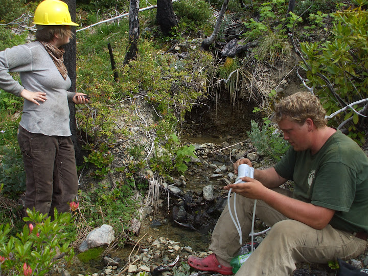
Seasonal water source at the base of Bailey Mtn, just off Bailey Mtn Trail No. 1109. June 22, 2010.
The only dependable source of water between Babyfoot Lake and Carter Creek is at Bailey Cabin Site, about 5.5-miles from the Babyfoot Lake Trailhead. In previous years, hikers have used these sources throughout most of June.
These sections of the Trans-Kalmiopsis Route are filled in with brush and downed logs, making hiking difficult, but the route is definable. The road to Babyfoot Lake Trailhead is snow free.
2013 Volunteer Appreciation Night
24 April 2013 | Ashland, OR --
What? Siskiyou Mtn Club 2013 Volunteer Appreciation Night, food, beverages, silent auction and award presentation.
When? May 4, doors open at 530pm, presentation starts at 630pm.
Where? Southern Oregon University's Schneider Art Museum, 1250 Siskiyou Blvd, Ashland, OR (corner of Siskiyou and Indiana)
The cost? FREE
Every year SMC crews work thousands of hours to see that Southern Oregon's hardest to reach, most threatened and spectacular backcountry trails are rehabilitated, maintained, and stay on the map for the next generation. These aren't your typical Saturday afternoon volunteers.
They pack into the wilderness and work for up to 15-days at a time from remote camps to recover public resources. Without their work, these trails would be lost forever.
So come show them your support. Saturday, May 4 is your chance to make a real difference.
Questions? Want an invitation in your mailbox? Email howegabe(a)gmail.com
A super special place: Rough & Ready Creek
| Upstream of Seats Dam |
But this area doesn't have to be elusive, and R&R has something for everyone. You should go hiking there the next chance you get, maybe on your way to or from the coast.
The easiest access is from Redwood Highway 199 just north of O'Brien, OR at the Rough & Ready Creek Botanical Wayside. A short trail is flat and graded well enough for strollers, perfect for a fun family hike along R&R's lower rocky banks.
| Mudsprings Trail |
Hikers who want to take it a step further, and explore Rough & Ready's upper reaches, can use the historic Mudsprings Trail which appears in map issues as early as 1917. But if you're going to hike Mudsprings Trail, use the 1996 O'Brien quadrangle, and the Buckskin Peak quadrangle map issued in 1996.
| Darlingtonia fen on the very much threatened Mudsprings Trail |
Follow FSR 442 for about a mile to the south bank of Rough & Ready Creek, where there is a primitive, unsigned, easy-to-miss trail heading west and upstream.
You can follow this route all the way to Mudsprings, but this non-wilderness trail is threatened by ongoing maintenance deferments and damage from the 2002 Biscuit Fire. We'd like to grow the capacity to rehabilitate this historic trail.
| Historic Mudsprings Trail filled in with trees killed by the 2002 Biscuit Fire. |
So you when you go out there, be Rough. Be Ready, and Leave No Trace.
- Pictures of lower Rough & Ready Creek
- O'Brien Quadrangle
- Bucksin Peak Quadrangle
- KS Trails interactive map
A very special place: the Wild Rogue Wilderness Area
| Hanging Rock, courtesy Mike Cooley |
There you will find the Rogue's wildest and most pristine tributaries, including West Fork Mule Creek, Blossom Bar Creek; Paradise, Burns and Tate Creeks, whose headwaters to confluence are enveloped in the wilderness boundary.
You'll find mining relics, cemeteries and cabin sites, all from a time long gone, when gold lured early settlers to this area. You'll find fish, game, old-growth and out-of-this-world geology. And if you get far from the river, you'll probably find yourself, too.
The 40-mile Rogue River Trail is popular for springtime backpackers, before the canyon's south-facing slopes get too hot. But to hike into the wilderness' recess for some unconfined solitude, the best access is by Mule Creek Trail No 1159.
It climbs about 8-miles from Tucker Flat Campground to Panther Ridge Trail No. 1253, which offers outstanding views of the Rogue Canyon, as well as access to Hanging Rock, an unusual outcrop that also offers unparalleled views. The ridges also offer great access to diverse game habitat.
Unfortunately, the Mule Creek Trail has suffered from ongoing damage after the 2005 Blossom Fire. Fallen, fire-killed trees and brush have choked a lot of it in, and without restoration work the historic trail is very much threatened.
| Flora Dell Creek confluence |
The trip is full.
To access the Wild Rogue, read the BLM's Rogue River Ranch brochure, which includes driving directions and other important information. Always be prepared; this area is remote and dangerous.
Subscribe to:
Posts (Atom)
