Seasonal water sources already dry

28 April 2013 | Kerby, OR -- Seasonal water sources on the Club's Trans-Kalmiopsis Route are already dry, limiting options for early season hikers who want to hike the nine miles from Babyfoot Lake Trailhead to the Chetco River. 

Hikers have enjoyed seasonal sources of water at the Bailey Cabin - Emily Cabin junction, as well as at the base of Bailey Mountain on Trail No. 1109. But this year, those sources are already dry, as snowdrifts still loom on the north facing slopes of Babyfoot Lake Rim Trail No. 1126 and Kalmiopsis Rim Trail No. 1124.

Seasonal water source at the base of Bailey Mtn, just off Bailey Mtn Trail No. 1109. June 22, 2010.

The only dependable source of water between Babyfoot Lake and Carter Creek is at Bailey Cabin Site, about 5.5-miles from the Babyfoot Lake Trailhead. In previous years, hikers have used these sources throughout most of June.

These sections of the Trans-Kalmiopsis Route are filled in with brush and downed logs, making hiking difficult, but the route is definable. The road to Babyfoot Lake Trailhead is snow free.

2013 Volunteer Appreciation Night

24 April 2013 | Ashland, OR --

What? Siskiyou Mtn Club 2013 Volunteer Appreciation Night, food, beverages, silent auction and award presentation.

When? May 4, doors open at 530pm, presentation starts at 630pm.

Where? Southern Oregon University's Schneider Art Museum, 1250 Siskiyou Blvd, Ashland, OR (corner of Siskiyou and Indiana)

The cost? FREE


Every year SMC crews work thousands of hours to see that Southern Oregon's hardest to reach, most threatened and spectacular backcountry trails are rehabilitated, maintained, and stay on the map for the next generation. These aren't your typical Saturday afternoon volunteers.

They pack into the wilderness and work for up to 15-days at a time from remote camps to recover public resources. Without their work, these trails would be lost forever.

So come show them your support. Saturday, May 4 is your chance to make a real difference. 

Questions? Want an invitation in your mailbox? Email howegabe(a)gmail.com

A super special place: Rough & Ready Creek

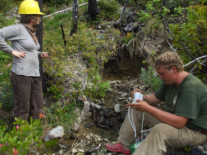
Upstream of Seats Dam
18 April 2013 | O'Brien, OR -- Rough & Ready (R&R) Creek is renowned by natural scientists who adorn the area for its outstanding biodiversity and most unusual geology. Across the web there's tons of information about the area, but very little direction on how to explore R&R for yourself, with your boots on the ground.

But this area doesn't have to be elusive, and R&R has something for everyone. You should go hiking there the next chance you get, maybe on your way to or from the coast.

The easiest access is from Redwood Highway 199 just north of O'Brien, OR at the Rough & Ready Creek Botanical Wayside. A short trail is flat and graded well enough for strollers, perfect for a fun family hike along R&R's lower rocky banks.

But don't stop there.

Mudsprings Trail
Download the O'Brien 7.5-minute quadrangle map issued in 1996 for free and use it to locate the old roads that provide access to Seats Dam, premier swimming holes, and exposed bedrock formations that are out of this world. R&R's lower, rocky reaches are best explored when the water is low, fording is easy, and walking in the creek bed is an option.

Hikers who want to take it a step further, and explore Rough & Ready's upper reaches, can use the historic Mudsprings Trail which appears in map issues as early as 1917. But if you're going to hike Mudsprings Trail, use the 1996 O'Brien quadrangle, and the Buckskin Peak quadrangle map issued in 1996. 
Darlingtonia fen on the very much threatened Mudsprings Trail
From the blinking light in O'Brien, OR, head west on Lone Mountain Road, right on Naue Way, and then left on FSR 011 (Rough & Ready Creek Rd). Drive slowly and be considerate of the neighbors. You'll come to a gate that says "Foot Traffic Only." Park there and walk past the gate.

Follow FSR 442 for about a mile to the south bank of Rough & Ready Creek, where there is a primitive, unsigned, easy-to-miss trail heading west and upstream.

You can follow this route all the way to Mudsprings, but this non-wilderness trail is threatened by ongoing maintenance deferments and damage from the 2002 Biscuit Fire. We'd like to grow the capacity to rehabilitate this historic trail.
Historic Mudsprings Trail filled in with trees killed by the 2002 Biscuit Fire. 
Lace up your boots, study your topo maps and pursue other area destinations, like Alberg Mine, and the upper, deep canyon reaches of R&R. This area is known for being rugged and rocky, wild and forsaken.

So you when you go out there, be Rough. Be Ready, and Leave No Trace.

A very special place: the Wild Rogue Wilderness Area

Hanging Rock, courtesy Mike Cooley
15 April 2013 | Marial, OR -- The wild Rogue River is a popular destination, attracting thousands of whitewater rafters a year. But very few meander past the river corridor and far into the rugged 35,800-acre Wild Rogue Wilderness Area. 

There you will find the Rogue's wildest and most pristine tributaries, including West Fork Mule Creek, Blossom Bar Creek; Paradise, Burns and Tate Creeks, whose headwaters to confluence are enveloped in the wilderness boundary.

You'll find mining relics, cemeteries and cabin sites, all from a time long gone, when gold lured early settlers to this area. You'll find fish, game, old-growth and out-of-this-world geology. And if you get far from the river, you'll probably find yourself, too.

The 40-mile Rogue River Trail is popular for springtime backpackers, before the canyon's south-facing slopes get too hot. But to hike into the wilderness' recess for some unconfined solitude, the best access is by Mule Creek Trail No 1159.

It climbs about 8-miles from Tucker Flat Campground to Panther Ridge Trail No. 1253, which offers outstanding views of the Rogue Canyon, as well as access to Hanging Rock, an unusual outcrop that also offers unparalleled views. The ridges also offer great access to diverse game habitat.

Unfortunately, the Mule Creek Trail has suffered from ongoing damage after the 2005 Blossom Fire. Fallen, fire-killed trees and brush have choked a lot of it in, and without restoration work the historic trail is very much threatened.
Flora Dell Creek confluence
So this June the SMC is joining forces with Wilderness Volunteers, a national volunteer group, to start work on the route. Volunteers coming from around the US are going to camp from Tucker Flat Campground and work their way up Mule Creek Trail.

The trip is full.

To access the Wild Rogue, read the BLM's Rogue River Ranch brochure, which includes driving directions and other important information. Always be prepared; this area is remote and dangerous.

FOR IMMEDIATE RELEASE: SMC HIRING SCHOLARSHIP AND PAID TRAIL CREWS


Contact: Executive Director, Gabe Howe
Phone: 541-708-2056
Email: howegabe(a)gmail.com

FOR IMMEDIATE RELEASE: SMC HIRING SCHOLARSHIP AND PAID TRAIL CREWS

10 April 2013 | Ashland, OR – The Siskiyou Mountain Club is looking for high school seniors from southern Oregon who want to participate in a 15-day trail project and get $1500 for college.

The summer program runs July 2-16, and there is a mandatory orientation June 1-2. The youth crew will be rehabilitating and maintaining a network of trails in the Kalmiopsis Wilderness Area that has suffered from ongoing damage from the 2002 Biscuit Fire.

Participants will learn how to use a crosscut saw and properly remove brush, as well as adopt strong leadership and other life skills. They’ll spend fifteen days camping in the Kalmiopsis’ remote recesses.

Serving on the crew is the award’s only term. $1500 will be awarded through each participant’s college’s financial aid department. Only students attending accredited colleges starting fall 2013 are eligible. We highly encourage part-time, non-traditional and community college students to apply. ­­

“This can be a leg up in the work-force, and in the classroom,” says Austin Kasner, 2012 SMC volunteer, 2013 Southern Oregon University graduate, and employee at Standing Stone Brewery. “It definitely helped me get ahead.”

The Club is also hiring youth from southern Oregon for a 10-day crew later in July, working in Ashland’s Soda Mountain Wilderness Area on an ecological trail-conservation project. That is a paid-crew and the dates run July 23 – Aug 1, tentatively.

Apply online for the scholarship at http://goo.gl/lRDWG

Apply for employment at http://goo.gl/glyPZ

Preference will be given to applicants who apply for both. Applications will be accepted through April 30. Inquiries can be made to SMC Director Gabe Howe.

Gabe Howe
(541)708-2056
howegabe@gmail.com

Shoofly Trip Report

SOU students Kolby McNeal and Mike Jones logout an old-growth ponderosa
7 April 2013 | Ashland, OR -- Yesterday Siskiyou Mountain Club volunteers set out to get a head start on the winter's windfall on the Red Buttes Wilderness' Shoofly Trail. Winter left us lots of work.

We met at Medford REI at 9am, and reached the Shoofly Trailhead at 10:15am. Southern Oregon University intern Kolby McNeal gave the safety talk, and we started descending through groves of giant sugar pines, Douglas fir, and ponderosa pine.

From left to right: Mike, Brandon, Angie, Kolby, Jack
It didn't take long to reach an old-growth ponderosa that winter winds had blown down over the trail. It was about 3' in diameter.

We reached the Butte Fork Trail No 957 and headed upstream, running into more old-growth that had fallen on the trail. The largest tree we encountered was left for next time, and we suspect there are a lot more downed trees further up Butte Fork Trail toward Azalea Lake.

The Butte Fork Applegate River provided us a great lunch site. It was running high and clear.

We left this one for next time
Fresh windfall is still green, hasn't settled much, and has a lot of energy pent up in it. It's really important to figure out where the bind is, read your kerf, find out your safest quadrant to figure the cut, and have good escape routes.

Volunteers joining were Angie, Brandon, Jack, Kolby and Mike. The trip was led by SMC Field Coordinator Gabe Howe.

Crew leader Gabe Howe
Want to hike this trail? Click here for a field-guide.

A really special place

5 April 2013 | Ashland, OR --

The Shoofly Trail in the Red Buttes Wilderness is a really special place.

The trailhead, just south of Applegate Lake, is at less than 3,500 ft. elevation; that's low hanging fruit. From there, the trail winds itself down a slope into the Butte Fork Applegate River and Trail 957, which leads to a historic tool shed, as well as Azalea Lake.
Sugar pine
Along Shoofly are gargantuan sugar pine trees. My guess is they are some of the world's largest.

But along this easy-moderate spring hike, I like to look down. Each year an unusual form of plants comes up from underneath the protection of these giant trees. Saphrolytes are plants that grow without using chlorophyll. Instead they depend on the root systems of old-growth trees.
Snow-plant (Sarcodes sanguinea)
Every year this trail fills in with some windblown trees, and because it's in a federally designated Wilderness Area, no chainsaws are allowed. So tomorrow, a group of SMC volunteers are packing in a couple of crosscuts to see what winter left us.

We'll let you know how far we get!

We need gear


4 April 2013 | Ashland, OR -- The Siskiyou Mountain Club needs gear.

We have a growing number of volunteers eager to put their sweat and time into the trail, but who simply cannot afford high-ticket items, such as quality boots, needed to do trail work. Unfortunately, I'm having to turn down willing participants -- namely youth -- who just can't participate because of the cost.

A pair of good boots is at least $100, which is a lot of money for college students paying unprecedented tuition rates, and youth living in areas with historic poverty and unemployment rates.

We're interested in working with area retailers, such as REI, who may be interested in helping our most committed volunteers with the cost of gear. Please email howegabe(a)gmail.com if you are a retailer interested in sponsoring our youth today. 

Wanna get out this spring?

\

1 April 2013 | Ashland, OR -- Get out this spring, into the Siskiyous, do something different, and see somewhere new. Make a difference, and meet people who show real passion for backcountry adventure.

Red Buttes Wilderness Area
Sat, April 6, Red Buttes Recon -- Get ahead of the winter windfall and check out some of the largest sugar pine trees in the world, Red Buttes Wilderness Area. We'll crosscut any new downed logs and clip brush on the Shoofly Trail. Carpools leave Ashland at 830am, Medford at 9am. Back to Medford by 6pm.

This trip is moderate - difficult.

Email howegabe(a)gmail.com for details and to sign-up.

Sat, April 13, Bigfoot search continued -- Join the crew from Starbucks Coffee for a day brushing out the Collings Mountain Trail. Checkout the infamous Bigfoot Trap near Applegate Lake, and join us for a barbecue to follow. Email howegabe(a)gmail.com for details and to sign-up.

This trip is moderate-difficult.

Sat, April 27, Illinois Valley Forests and Rivers Festival -- Join the Club and others for a fun day of children's activities in Cave Junction, OR. Details at www.ivstream.org

This event is easy.

Sat, May 4, Volunteer Appreciation Night -- Every year SMC crews work thousands of hours to rehabilitate and maintain backcountry trails threatened by natural disasters and historic maintenance deferments. Join us May 4 to show them your support.

Southern Oregon University's Schneider Art Museum. Doors open at 530pm. Silent auction, appetizers and beverages. Presentation at 630pm. Inquiries? Email howegabe(a)gmail.com.

This event is easy.

Soda Mountain Wilderness Area
May 25 - 27, Kalmiopsis logout -- Backpack 5-miles into the Kalmiopsis Wilderness Area from Babyfoot Lake and help clean up our trail to the Chetco. Come see what is so wild about the Kalmiopsis. Click here for more details and to sign-up.

This trip is difficult to strenuous.

June 7 - 8, Soda Mtn Logout -- Join forces with the Pacific Crest Trail Association to maintain 20-miles of the PCT in the Soda Mountain Wilderness, less than an hour from Ashland. Huge views, lots of flowers, and more fun. Email howegabe@gmail.com for details and to sign up.

This trip is moderate to difficult.